


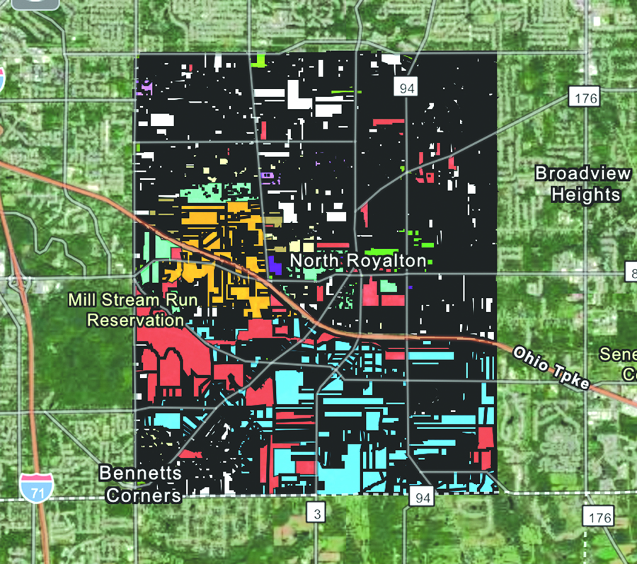
After several months in the making, the City of North Royalton recently launched an online, interactive map of all resident, business and industrial properties in the City. The aim of the new offering was to streamline the information process for the public, which can now be had with a click of a button.
Mayor Larry Antoskiewicz stated that “Developers like to look and hit the buttons before they even call. They like the information beforehand, as far as zoning, and other information. It’s another tool. Even for residents, when they want to know what is going on. This gives them an opportunity to look and see. Even though the Master Plan had been passed some time ago, this gives the opportunity to see the whole thing. It’s a good, positive tool to move forward.”
The map can be customized to show all parcels; a color coded map that shows all zoning classifications, including Residential, Multi Family, Senior Citizen, Rural Residential, Public Facility, Office Building, Local Business, General Business, Motorist Service, Research Office, Commercial Services, General Industrial, Planned Unit Development and Traditional Town Center; TCD zoning districts, city boundaries and council wards. The parcel information will be updated when Cuyahoga County updates their records, which takes place roughly every few months.
To access the interactive map, go to the City’s website, www.northroyalton.org. Click on the Department tag at the bottom of the page, then click on the Community/Economic Development tag on the left. Click on the Maps Section on the left. In the middle of the page, click on the North Royalton Community Map tag. By clicking on each parcel, the name(s) of the current owner is shown, the permanent parcel number, the address, and the total frontage and acreage.
By GLORIA PLEVA KACIK
Contributing Writer